Restoration · Part of Buffelsdrift
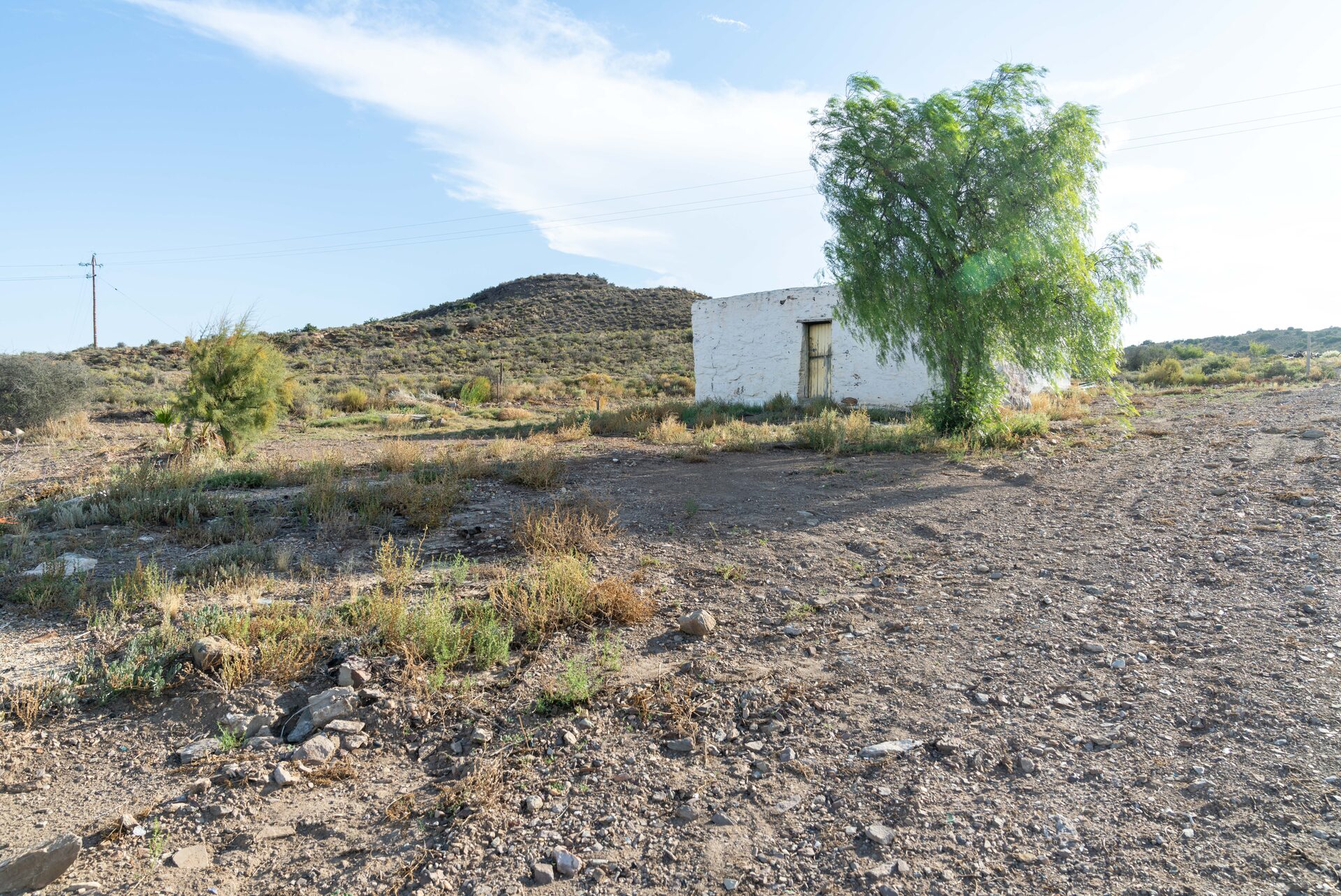
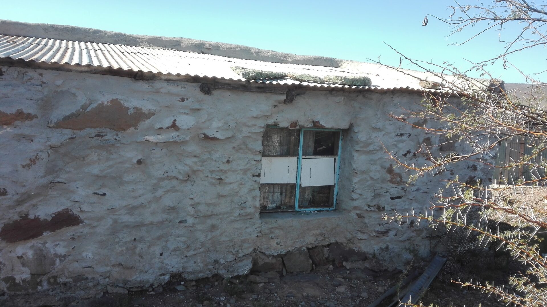
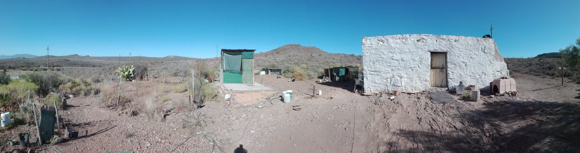
Die Skaapwagtershuisie at Buffelsdrift had been the home of Cornelius Appel, a farm labourer, for most of his life. Though recorded as a nineteenth-century structure, the building may be considerably older. The Buffelsdrift farm originated as a VOC-era loan farm — a leningsplaats — one of the circular 3,000-morgen grants that the Dutch East India Company formalised after 1714 to push trekboer settlement deeper into the Karoo interior. This was the colonial system set in motion by Simon van der Stel, Governor of the Cape Colony from 1691, whose expansion policies opened the interior to grazing farmers moving steadily east and north from the Cape. The circular boundary of the original grant is still legible in today’s cadastral record: the arc of the farm’s outer boundary, visible on the FarmMapper GIS system, preserves the geometry of the original VOC circle measured out from the homestead — a three-century-old land claim still written into the landscape.
If the farm was established in the early 1700s, this cottage may have stood through the full arc of the Bushman Wars — the decades-long series of violent conflicts between San communities and settler farmers that marked the Klein Karoo frontier throughout the eighteenth century, peaking in intensity between roughly 1770 and 1800. A stone structure this remote, this simply built, would have been both shelter and marker: the edge of what the colony considered tamed ground.
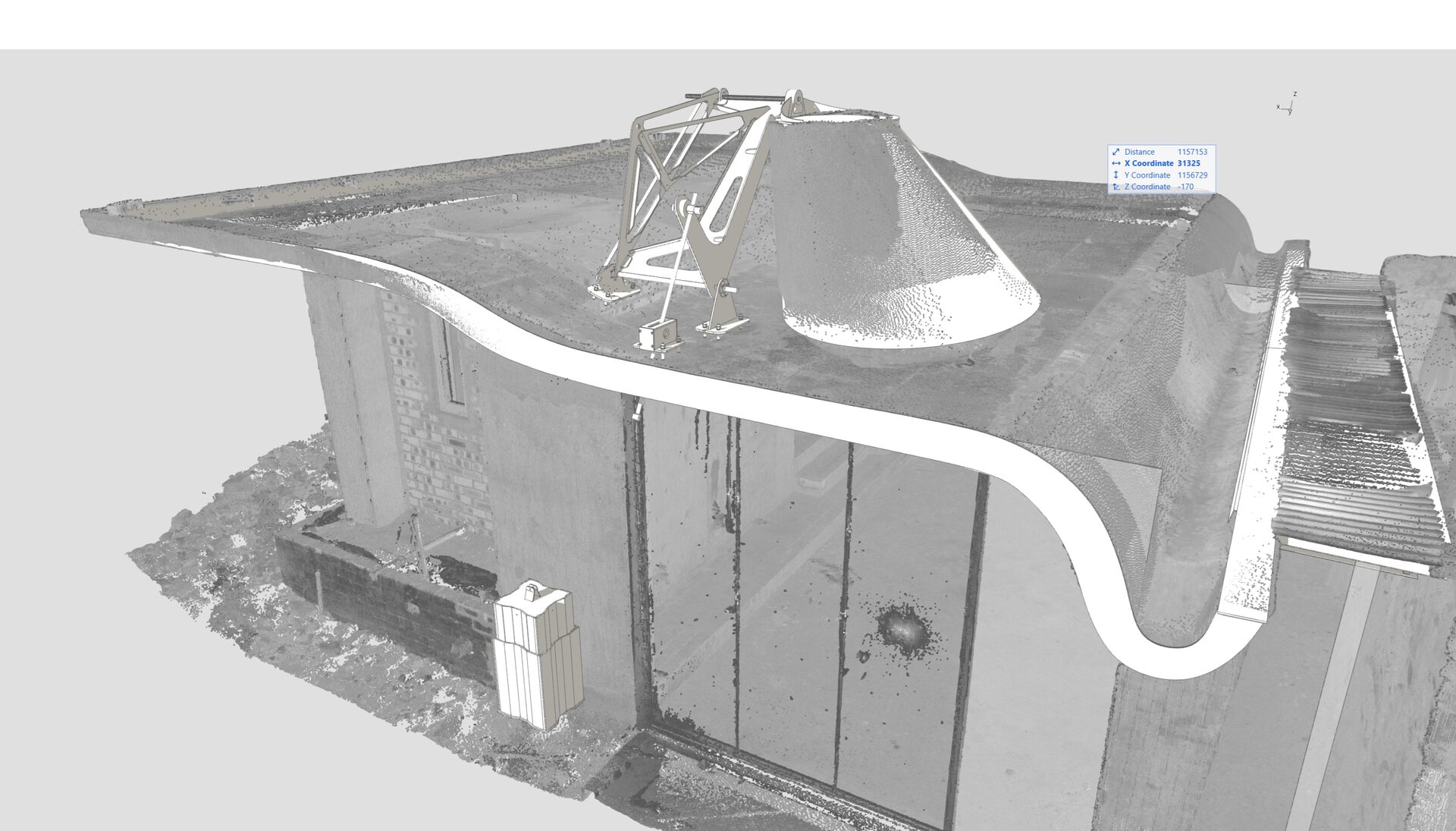
Built by hand, its walls follow no geometric logic that conventional CAD software can engage with directly. Every surface is irregular. Every corner is unique. The stone had been laid over generations without drawings, without tolerances, without reference to any coordinate system.
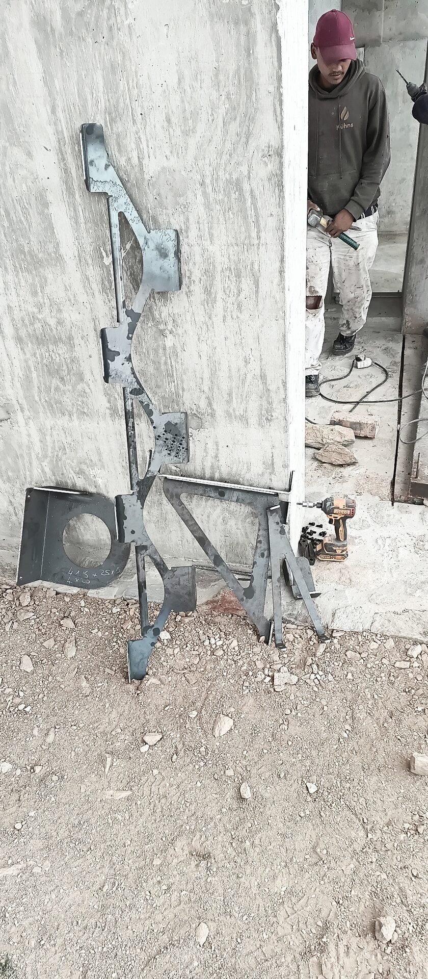
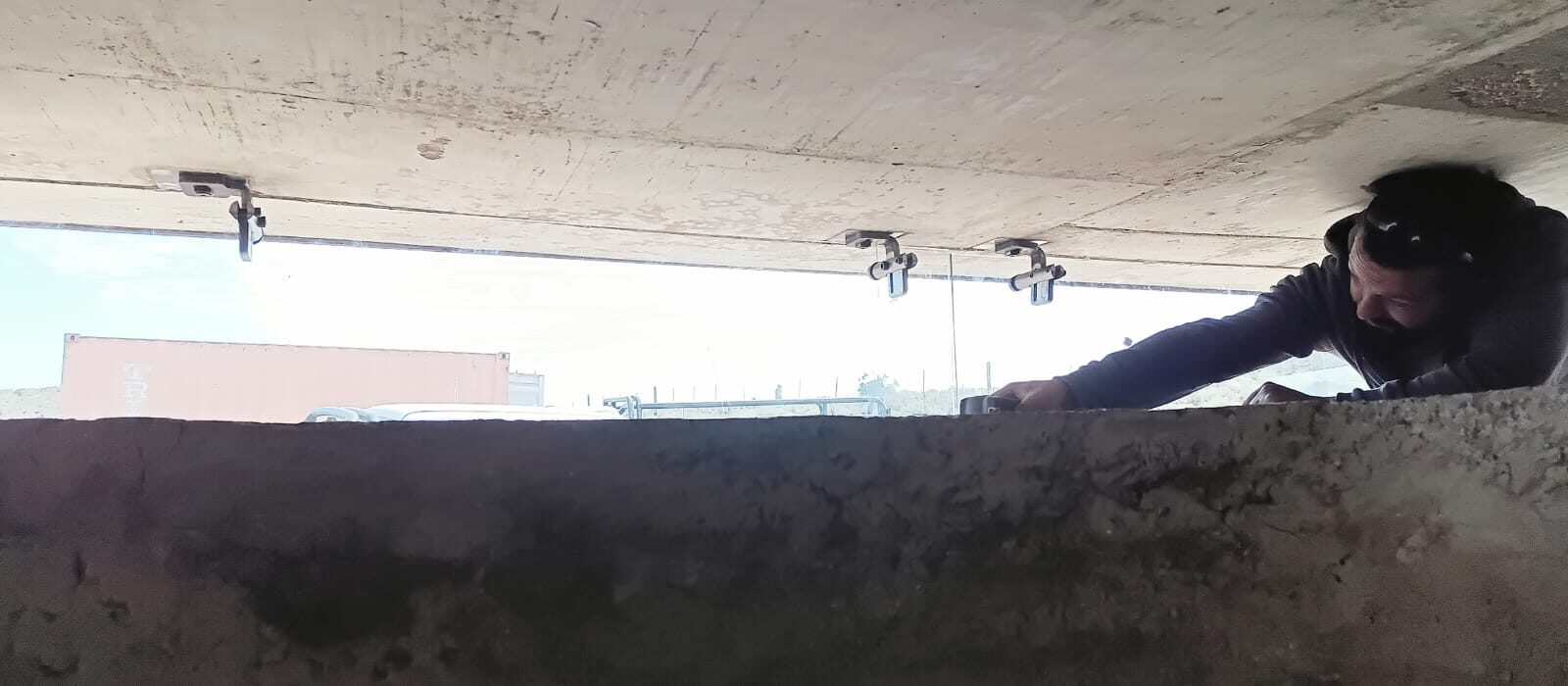
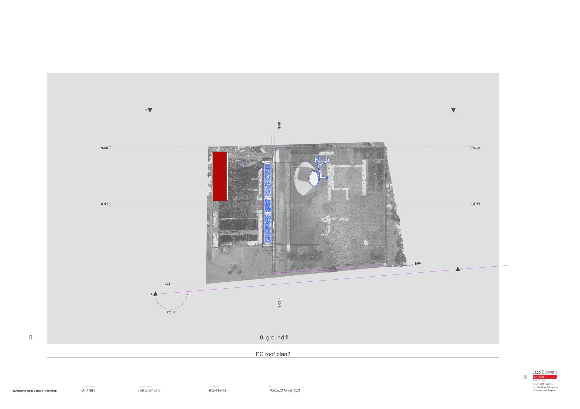
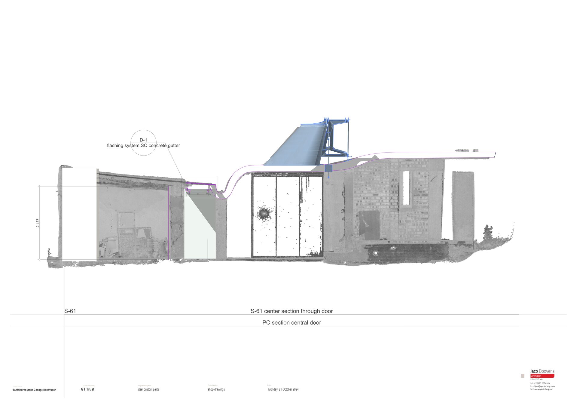
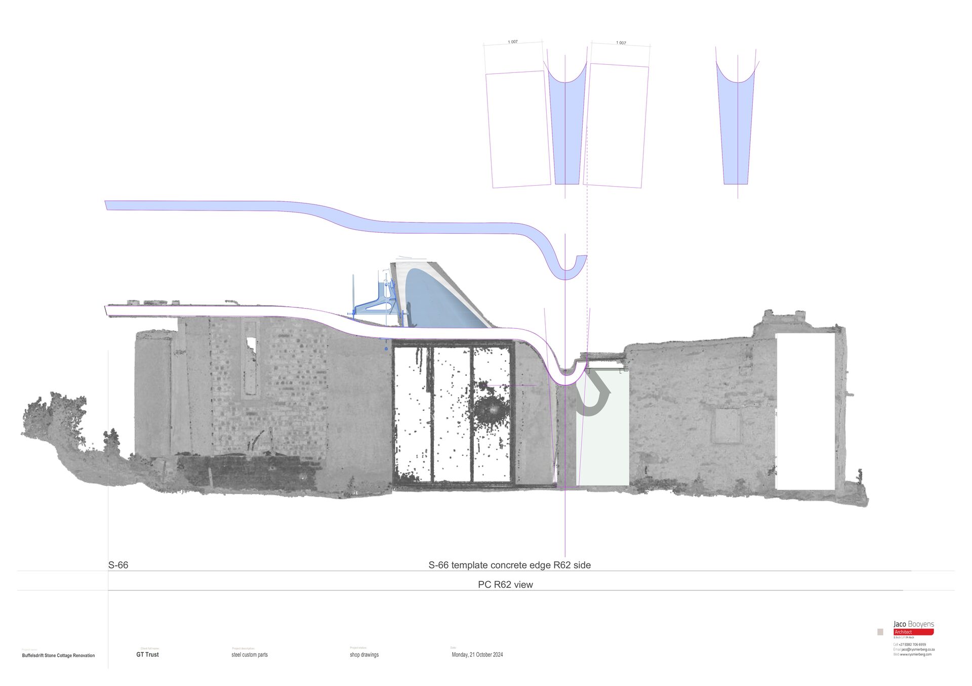
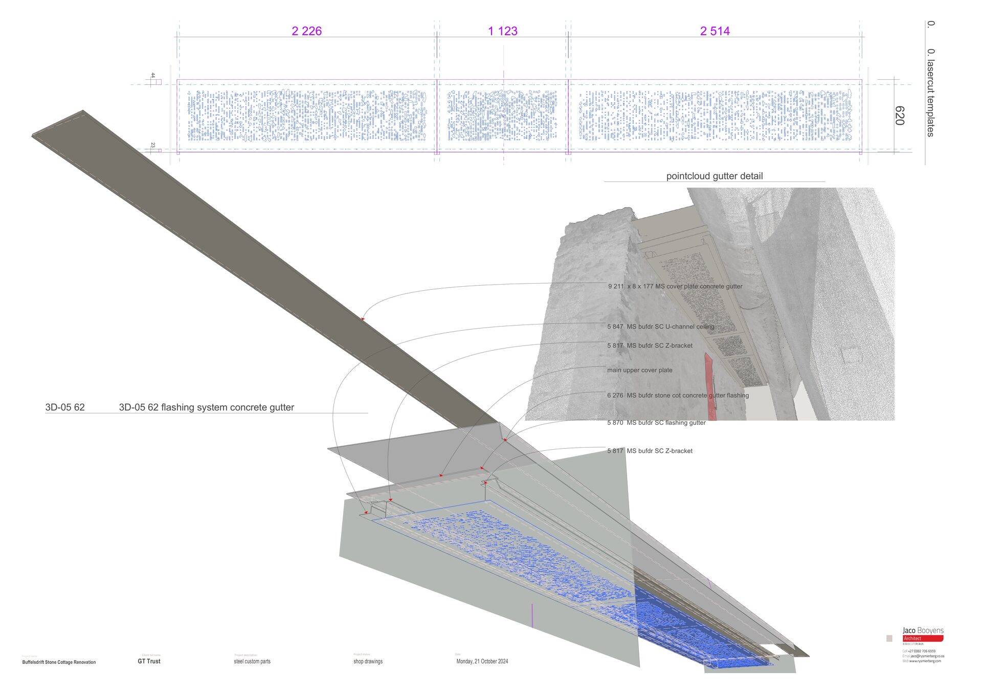
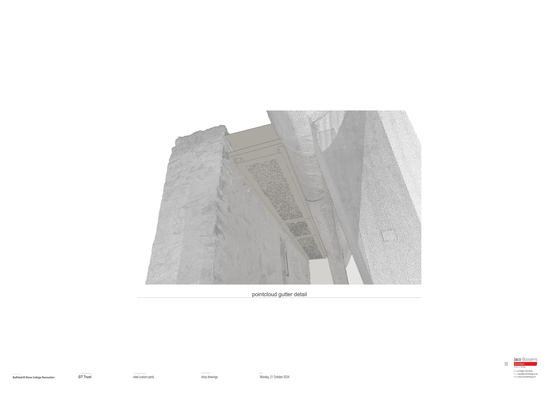
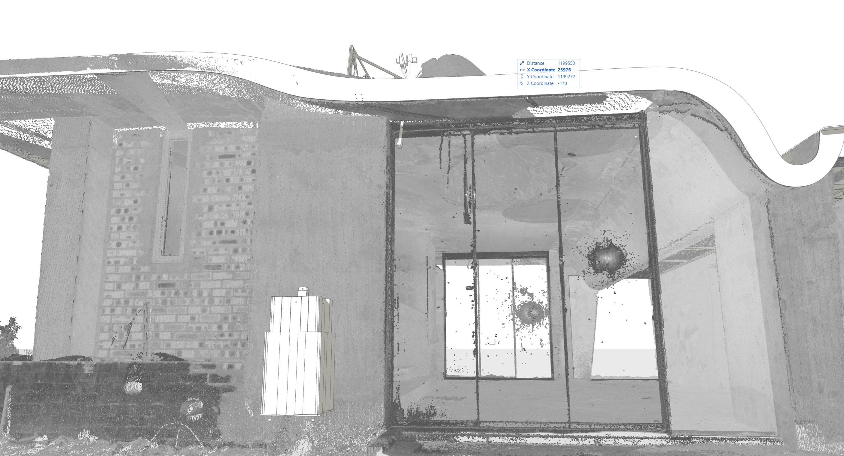
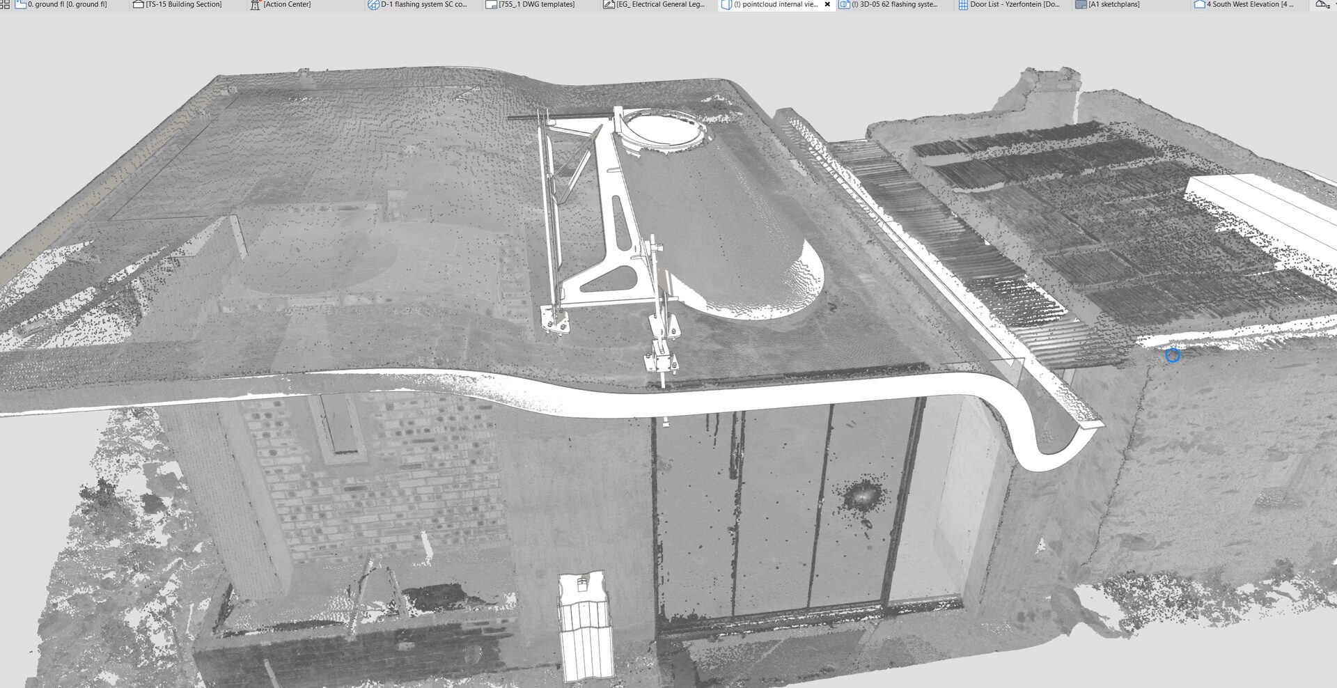
Booyens's approach was borrowed from dental prosthetics: scan the patient first, then fabricate the fitting. Using photogrammetric point cloud capture in ArchiCAD, every surface of the existing stone structure was recorded in three dimensions. The point cloud became the template — the exact, irregular geometry of the walls, the openings, the roof line — against which every new element was designed to mate.
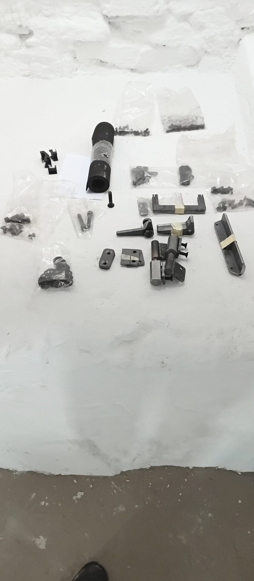
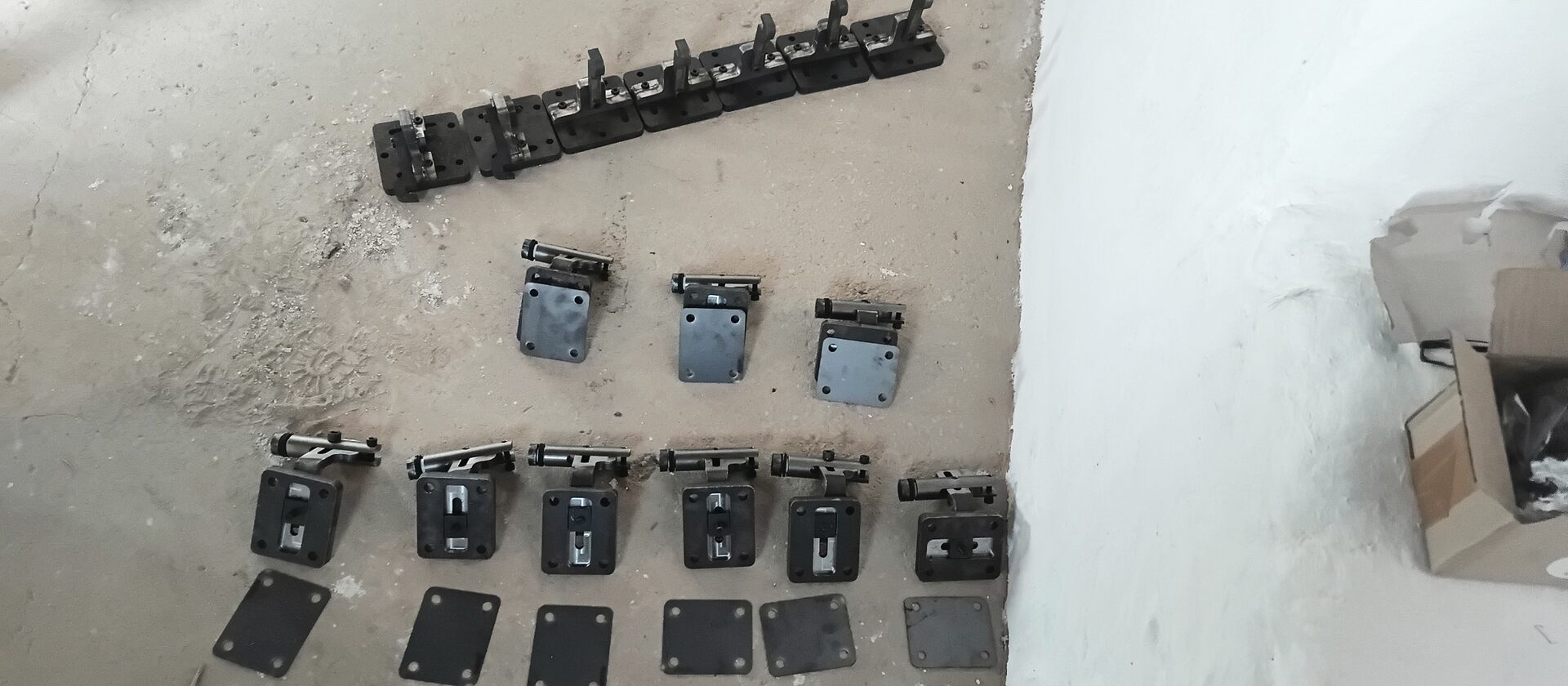
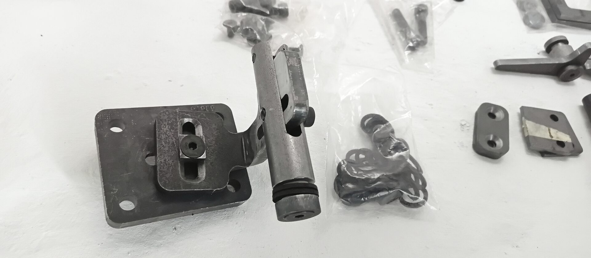
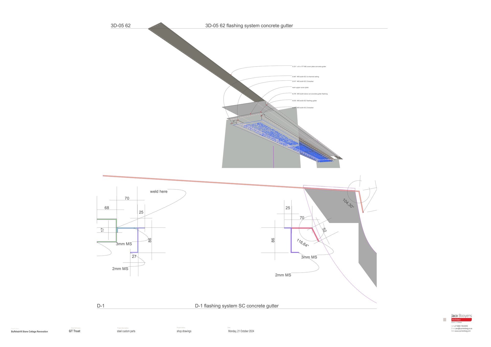
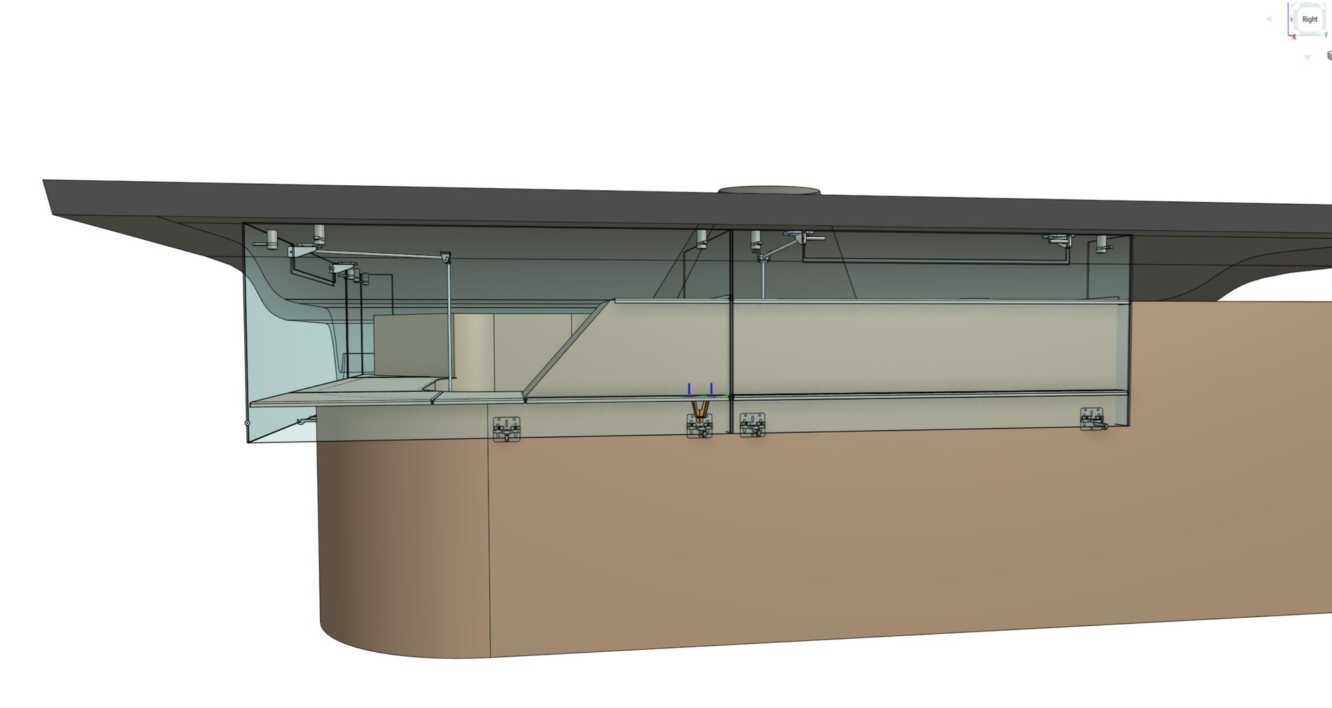
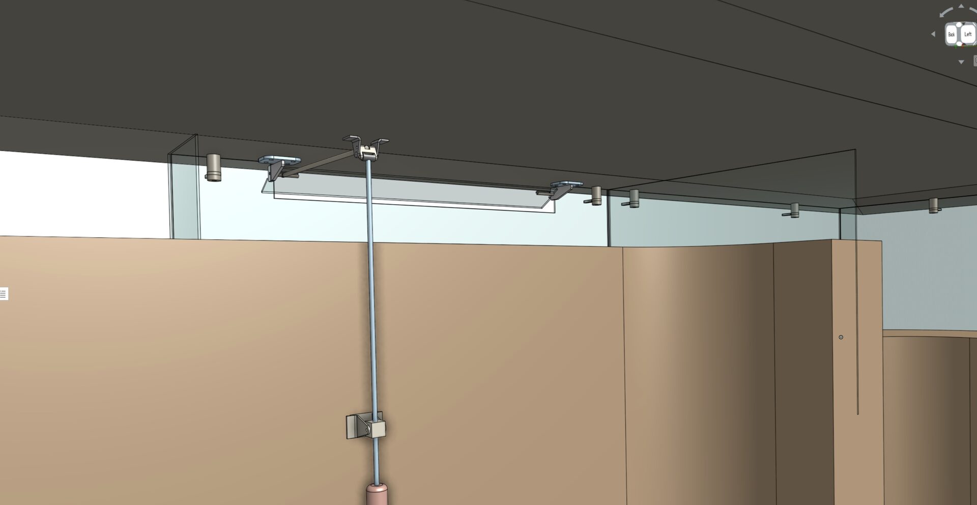
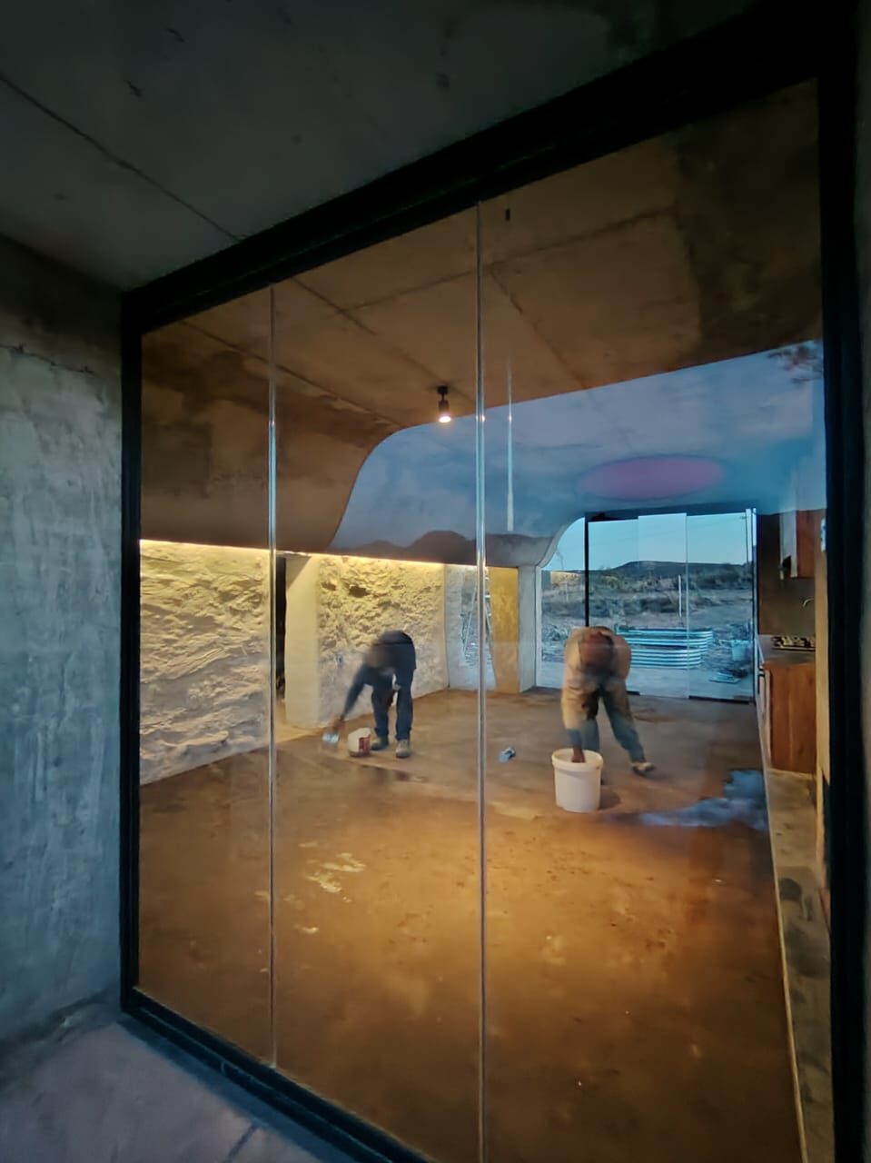
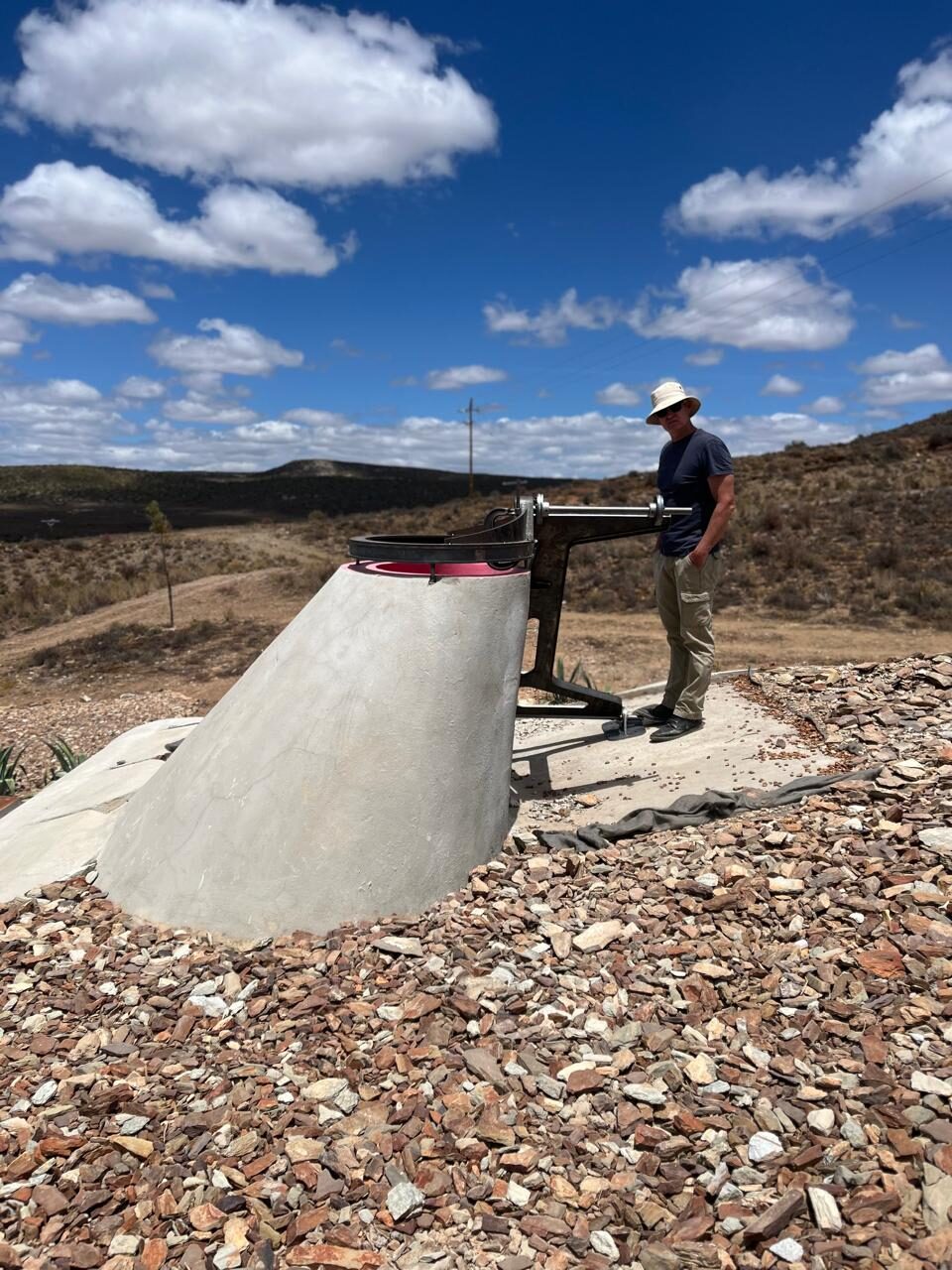
The point cloud was opened in ArchiCAD, where thin sections were cut through the data at specific material interfaces — wall heads, sill lines, jamb faces — to extract template outlines of the actual geometry. These section outlines, drawn directly from the stone, became the input geometry for Onshape, where every bespoke fabricated component was modelled to fit: machined steel connectors, folded plate elements, glass hangers, sliding systems, and the timber and steel parts that tie the new concrete shell to the ancient stone. Nothing was designed to a standard dimension. Everything was designed to fit this specific building.
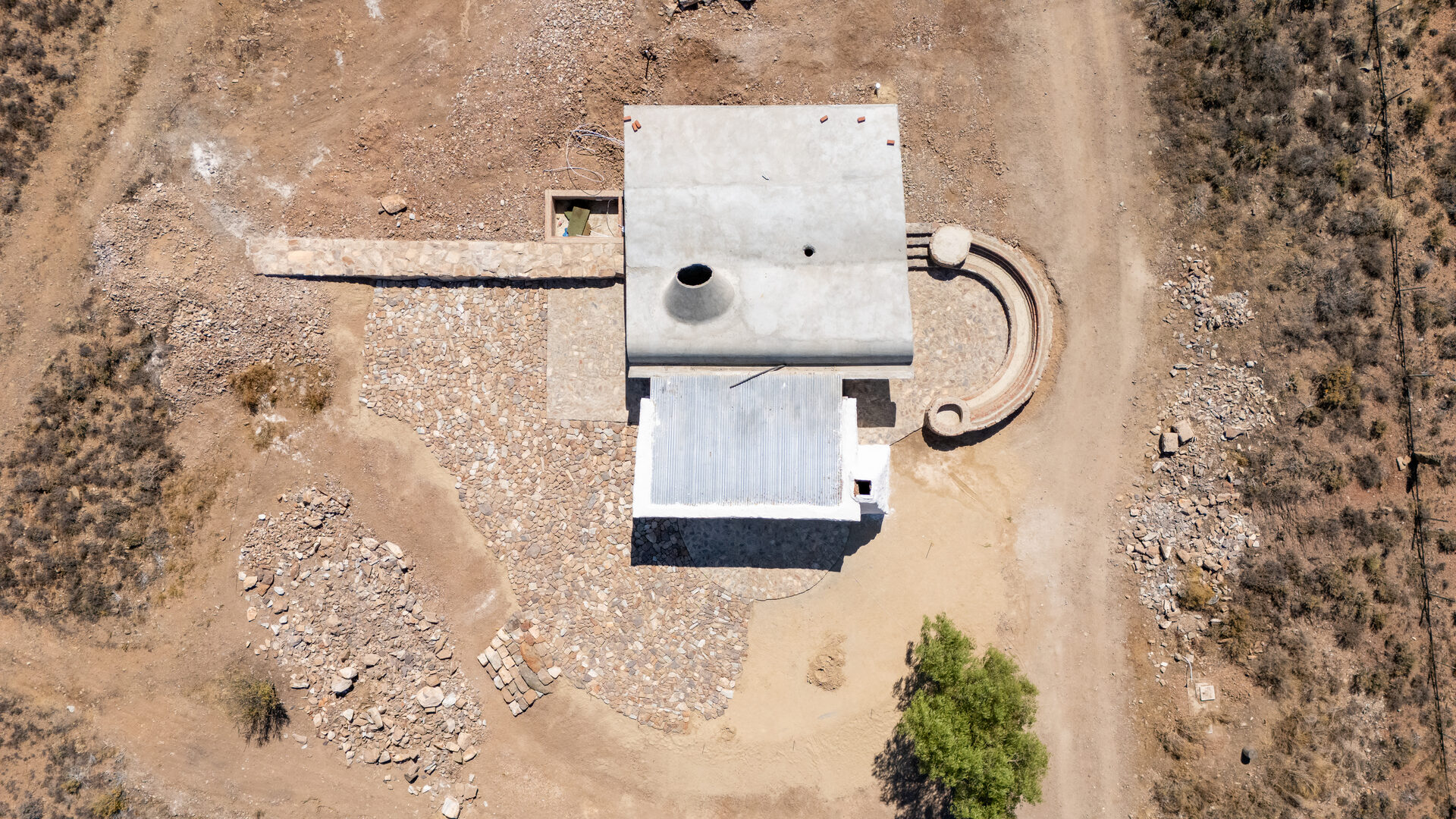
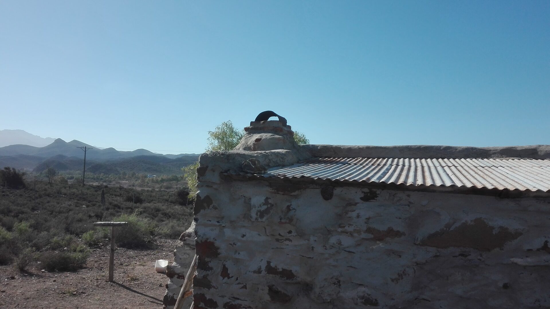
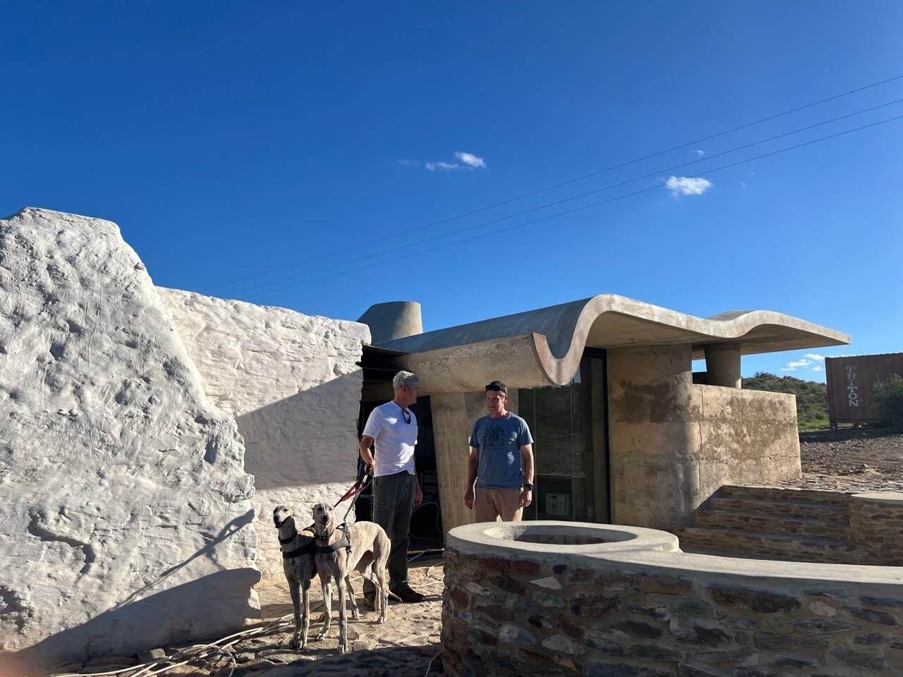
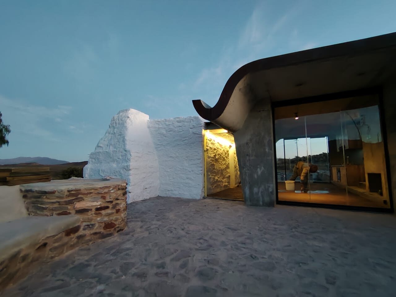
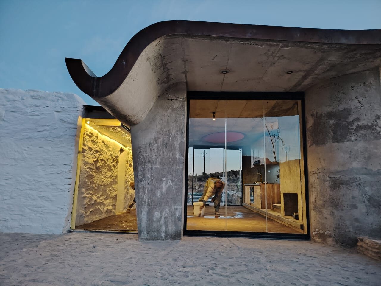
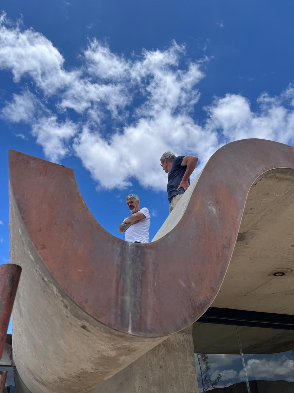
The freeform geometry of the concrete roof was modelled in Rhino3D — surfaces that cannot be described by simple extrusions or standard CAD primitives, but require the kind of free-surface modelling that Rhino handles natively. In its formal logic, the concrete roof draws directly on the brakdak tradition of the Karoo: the flat, heavy, thermally massive roof that Karoo builders devised over centuries in a landscape where timber was scarce and diurnal temperature swings are extreme. Gabriel Fagan documented this tradition in his book Brakdak: Flatroofs in the Karoo (2008) — a record of farm buildings photographed between 1959 and 1964, many since demolished. The brakdak was constructed from poplar beams, Spanish reed, and a compacted layer of brak clay — the high-salt, alkaline soil of the Karoo — which hardened into a watertight thermal lid. It is earthen construction in its most direct form: the landscape becoming the roof.
This is not a tradition unique to the Cape. Flat earthen roofs built for thermal mass are the dominant building response to arid climates across Africa and the wider world — from the Sudano-Sahelian mud architecture of West Africa to the adobe buildings of the American Southwest. In the Karoo, settler and indigenous builder arrived at the same solution by the same logic: mass absorbs heat by day, releases it at night, and the extreme swing of the desert climate is absorbed into the building fabric rather than fought with energy. The concrete roof of the Skaapwagtershuisie belongs to this lineage — a contemporary casting of an ancient idea.
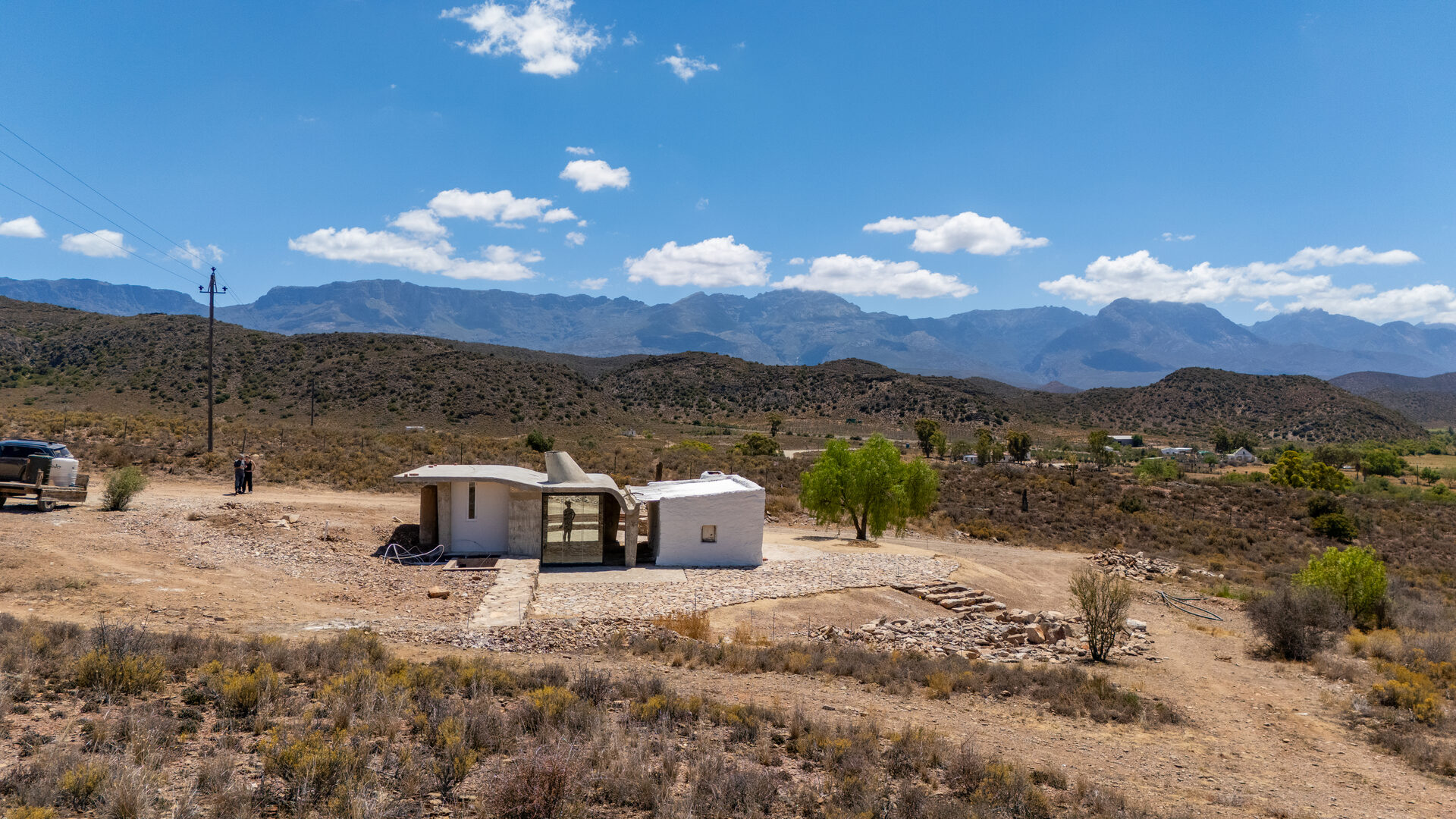
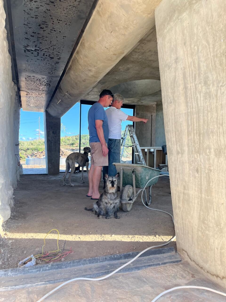
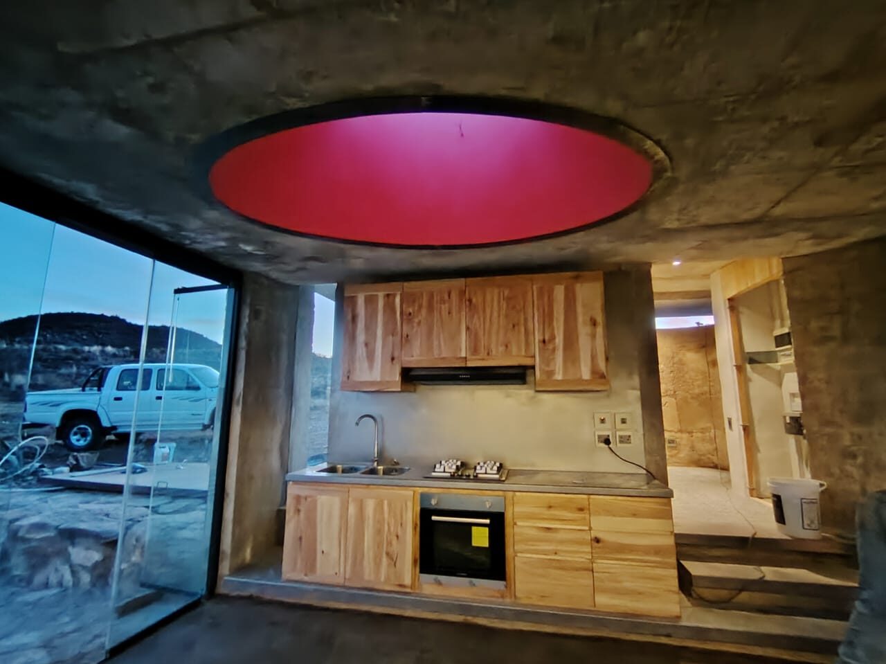
The result is a new concrete canopy — curved, hovering — inserted over and around the existing stone cottage without disturbing its material character. The stone remains stone. The concrete is unmistakably concrete. The joint between them is the work.
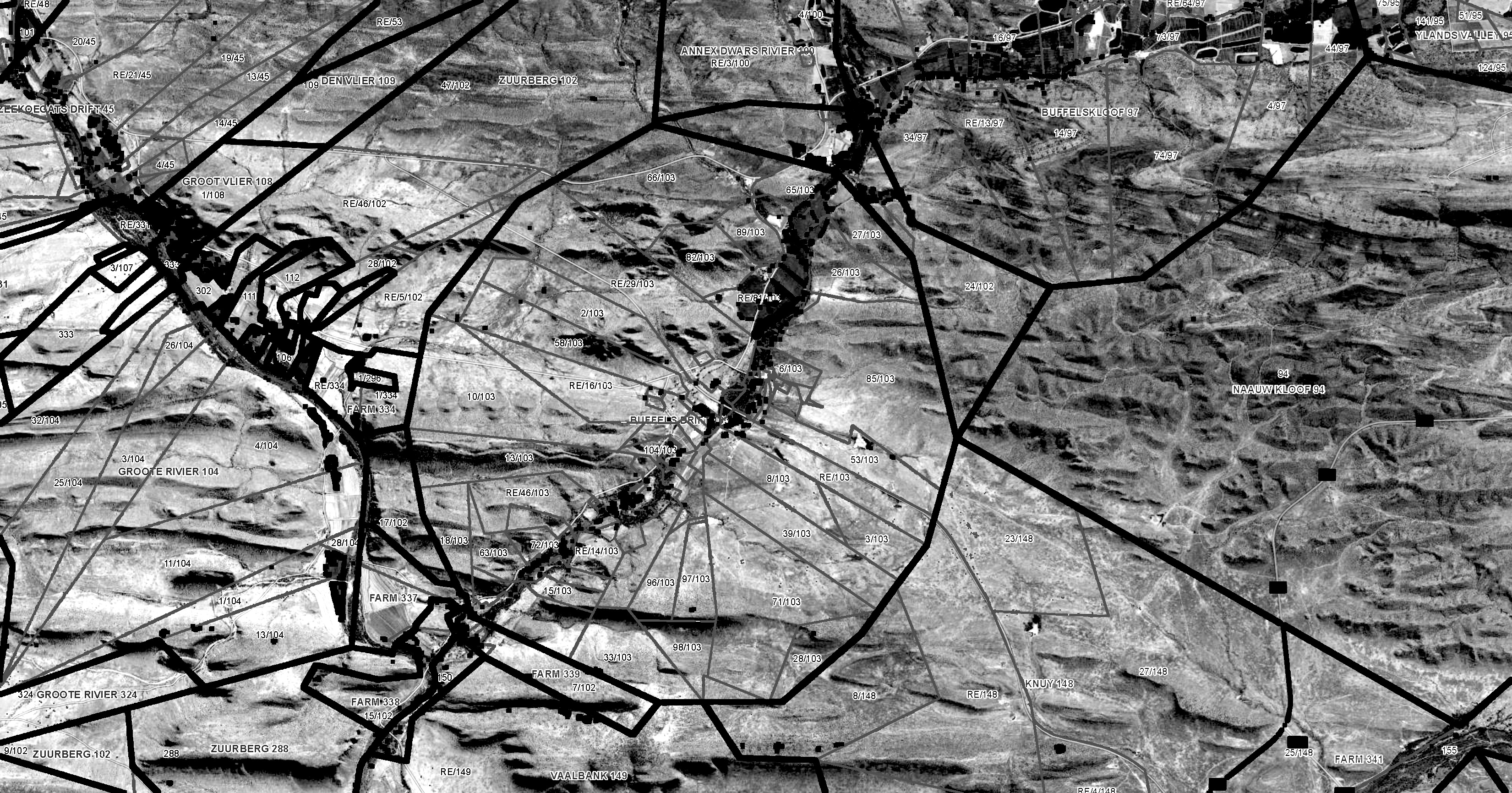
FarmMapper cadastral record — Buffelsdrift, Klein Karoo. The thick outer arc traces the original VOC leningsplaats boundary — a circular 3,000-morgen grant measured out from the homestead, formalised after 1714. The geometry of a three-century-old land claim, still written into the cadastral record. Source: FarmMapper GIS system (farmmapper.co.za).
.jpg)
Every hardware component was custom-designed in Onshape from the point cloud data and fabricated to tolerances the original stone builders never required: glass hangers, sliding mechanisms, folded-plate connectors, machined brackets. The same methodology as Yzerfontein — parametric geometry driving physical fabrication — applied to a nineteenth-century building that predates digital tools by a century.